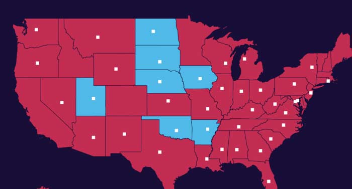
The coronavirus outbreak has resulted in unprecedented quarantine measures in America, from stay-at-home orders to limitations on travel.
The restrictions on movement began in late January, with the U.S. imposing entry restrictions on foreign nationals who have traveled anywhere in China within 2 weeks, and quarantines on Americans returning from Hubei Province. At the time, there were seven confirmed cases in the U.S.
Fast forward to April, where almost all states have stay-at-home orders limiting domestic and international travel and imposing social distancing guidelines, the U.S. is now attending to 609,995 cases as of April 15.
The restrictions were put in place to slow the spread of the virus, and there is early evidence that the spread is slowing in areas hit hard like New York.
It is unclear when social distancing measures will be lifted in various states. Various public health experts warn that in some instances, restrictions such as social distancing will need to remain in place to contain the virus, well into 2021 or even 2022.


