
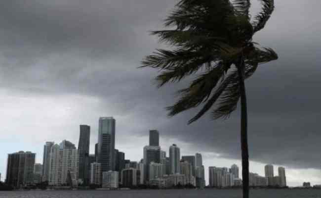
bdmetronews Desk ॥ Isaias was forecast to be near hurricane strength as it approached the Carolinas Monday, just a day after bands of heavy rain from the storm lashed Florida’s east coast.
The U.S. National Hurricane Center issued a hurricane warning from South Santee River, South Carolina, to Surf City, North Carolina, in its 5 a.m. advisory. Tropical Storm Isaias had maximum sustained winds of 70 mph (110 kph) and was expected to strengthen into a Category 1 hurricane, with winds of 74 mph (119 kph) or more.
“We are forecasting it to become a hurricane before it reaches the coast this evening,” senior hurricane specialist Daniel Brown said. “It’s forecast to produce a dangerous storm surge, of 3 to 5 feet (0.9 to 1.5 meters) in portions of North and South Carolina.”

Isaias — pronounced ees-ah-EE-ahs — could bring heavy rains, too — up to 8 inches (20 centimeters) in spots as it moves up the coast, Brown said —and “all those rains could produce flash flooding across portions of eastern Carolinas and mid-Atlantic, and even in the northeast U.S.”
Over the weekend, Isaias brought heavy rain and flooding to Florida as officials kept a close eye on the storm while dealing with surging cases of the coronavirus.
The storm had weakened from a hurricane to a tropical storm on Saturday afternoon, and its most damaging winds remained offshore.
VERO BEACH, Fla. (AP)